

The Anvil [Tory Island]
Good walks are even better shared.
B8746 : Balor's soldiers
Kay Atherton Photo source
Overview
The Anvil [Tory Island]
Overview
Nestled in the breathtaking landscape of Tory Island, The Anvil poses not just a visual treat for hikers but also demands a sense of respect for the environment and safety. Standing at 120 meters, this Marilyn offers a blend of moderate challenge and captivating scenery.
Geology
The Anvil showcases metamorphosed sandstone and schist, a testament to the geological forces that have shaped this region over the centuries. The ruggedness of the cliffs evidence the battle against time and the relentless power of the Atlantic.
Routes
The most popular route to The Anvil is the Island Circuit Trail, which is a well-trodden path starting from the main village. At 5 km long and taking about 2 hours to complete, it allows hikers to soak in the stunning environment while keeping their feet on solid ground (or as solid as one can find around here!).
Summit Features
Upon reaching the top, you will find a rocky outcrop that looks exactly like what you'd expect an anvil to look like—only slightly less useful for blacksmithing. A small cairn marks the summit, where you can rest, take photos, and wave at the local seabirds who will likely judge your hiking skills.
Terrain Type
Expect varying terrain with rocky paths, grassy stretches, and occasional damp areas. It's recommended to wear sturdy hiking boots unless you fancy a good mud wrestling match with the terrain.
Views
The summit rewards your effort with awe-inspiring views of the Atlantic and Donegal’s rugged coast. On particularly clear days, the sights are nothing short of majestic, making it an Instagram dream (or perhaps an Instagram “why didn't I bring my good camera” moment).
Hazards
As you navigate the rocky paths, watch your step. The terrain can be treacherous after rain, and the unpredictable weather characteristic of coastal regions means you should be prepared for anything—sun or sudden squalls, it’s all in a day’s hike.
Nearby Summits
Combine your adventure with a visit to Tory Head, the island's highest point at 152 meters, for a little extra legwork!
Access
Getting to The Anvil requires a ferry trip from Bunbeg, a quaint coastal town about 10km away. Parking is limited near the ferry terminal, so arriving early is wise.
Facilities
Once on Tory Island, facilities are basic but sufficient: a café and restrooms are available in the village, but don't expect a five-star dining experience—it's all about the adventure out here!
History
Tory Island, combining stunning landscapes and a rich history, gets its name from the distinctive shapes found in its geography. This enchanting spot is steeped in Celtic mythology and tradition, making it not just a place to hike but a realm of stories.
Embarking on this trek to The Anvil on Tory Island combines a thrill of adventure with a pinch of history, creating a memorable outing for any hiker keen on exploring the lesser-known gems of the UK.
Whether you’re a seasoned hiker or a curious wanderer, The Anvil stands ready to welcome you with arms wide open—just remember to use your legs to climb!
Explore routes near The Anvil [Tory Island]
Walks starting near this hill. Open a route to check its map, distance and full itinerary.
Route planning notes
These notes describe possible approaches. Check a route's map and access information when planning your walk.
Island Circuit Trail
A scenic route starting from the village on Tory Island, weaving around the island with The Anvil as a highlight. The path is well-marked and offers a chance to enjoy the local flora and fauna.
Make a day of it, together
Find someone to share the walk with, or organise a day out along a route you like.
Photo Gallery
View all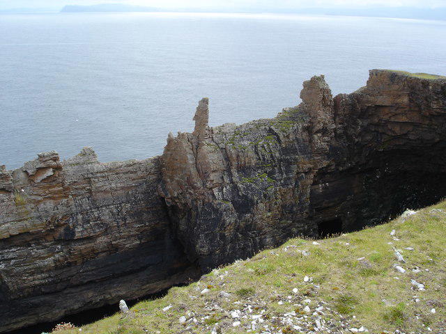 Photo could not load
B8746 : Balor's soldiers
Kay Atherton
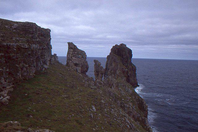 Photo could not load
B8746 : An Tor Mór
Richard Webb
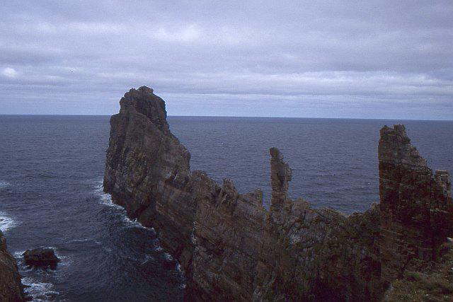 Photo could not load
B8746 : An Tor Mór
Richard Webb
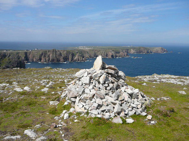 Photo could not load
B8746 : Dun Balair Fort, the highest point on Tory Island
Colin Park
Hill facts and local notes
Classifications
Elevation
83m
272 ft
Prominence
83m
Coordinates
55.2617, -8.1942
B877461
OS Map
1
At the Summit
The summit features a distinctive rocky outcrop which resembles an anvil, giving the mountain its name. There is a small stone cairn at the top, offering a perfect spot to rest and take in the views.
Terrain & Geology
The Anvil is composed primarily of metamorphosed sandstone and schist, showcasing a rich tapestry of geological history beneath its rugged exterior. The island's dramatic cliffs have been shaped by millennia of coastal erosion, making it a striking study for geology enthusiasts.
Views & Scenery
From the summit of The Anvil, one can see the sprawling Atlantic Ocean, the rugged coastline of Donegal, and the distant peaks of the mainland. On a clear day, this vista is truly breathtaking.
History & Heritage
Name Origin
The Anvil received its name due to the unique shape of its summit resembling a blacksmith's anvil.
Historical Significance
Tory Island has a rich cultural history, being inhabited since prehistoric times. It is also known for its strong connections to Celtic mythology and traditional Irish music.
Getting There & Facilities
Parking
There is limited parking available near the village of Tory Island. Cars must be parked respectfully considering local residents.
Public Transport
Access to Tory Island is primarily by ferry from the mainland, with services running regularly from Bunbeg.
Nearby Facilities
Facilities on Tory Island include a small café and basic toilet facilities in the village. Visitors are encouraged to bring their own refreshments.
Safety Information
Known Hazards
- The rocky terrain can be slippery, especially when wet. Be cautious of sudden weather changes in this coastal region.
General Safety Tips
- Check weather conditions before setting out
- Carry appropriate clothing and equipment
- Let someone know your planned route
- Take a map, compass, and GPS device
- Carry emergency supplies: food, water, first aid kit, torch
Hills
Some common questions about the hills answered
Are there group walks up The Anvil [Tory Island]?
Many walkers use Walkmates to join or organise walks with others. You can check for group walks around The Anvil [Tory Island] through the maps
Are there other walkers around The Anvil [Tory Island]?
Activity varies by location and time, but Walkmates lets you see whether others have shared walks or shown interest in this area. Find other people through the walking friends search walking friends for The Anvil [Tory Island] search or of course create your own walk for The Anvil [Tory Island]
Can I organise a walk to The Anvil [Tory Island]?
Yes. If there aren’t any walks listed already, you can create a walk and make it available for others to join.
If you're signed up to Walkmates, you can create a walk to The Anvil [Tory Island].
How do I find a walk up this hill?
There are often multiple ways to walk this hill, depending on experience and route preference. Walkmates helps you explore walks and routes that others have shared.
Can I suggest a new route up The Anvil [Tory Island]?
Yes. You can suggest or create routes to share with others. Walkmates focuses on the social side of walking, so routes are used to help people organise walks and explore areas together, rather than as detailed navigation tools or route libraries.
Other uses really appreciate knowledgeable walkers sharing their routes. Share your favourite route to The Anvil [Tory Island] here
The is an error or something incorrect about this hill. How do I let you know?
We always strive to keep the information on Walkmates as accurate as possible. If you find an error, please let us know through the contact form and we'll aim to correct it as quickly as possible
Community Discussion
Comments
Location
View the hill's mapped position and surrounding paths.
Grid reference: B877461
View on OpenStreetMapOpens a map in a new tab, centred on the hill.
No comments yet. Be the first.